
Understanding the Geography Behind One of the World’s Most Extraordinary Rivers
Sometimes the forces that shape civilisations are not political or cultural.
They begin with something more fundamental.
A landscape. A slope. The quiet certainty of gravity guiding a river toward the sea — and, in doing so, shaping the course of human history.
Standing on the banks of the Nile for the first time often brings a moment of surprise. The river moves steadily northward, eventually emptying into the Mediterranean Sea. On a map this can feel almost counter-intuitive, as the river appears to flow “upward” toward the top of the page.
Yet the Nile is not behaving unusually at all. It is simply following the most basic rule governing every river on Earth: gravity.
Water always flows from higher elevation to lower elevation. The Nile flows north because the highlands of East Africa sit far above the Mediterranean coast, creating a natural slope that guides the river toward the sea.
This simple geographical fact shaped the development of one of the most remarkable civilisations in human history.
Rivers Follow Gravity, Not Compass Directions
Many people assume rivers normally flow south, but this is a misconception. Rivers have no preferred direction on a compass. Their course is determined entirely by the topography of the land they cross.
If the land slopes northward, the river will flow north. If the terrain slopes east, west, or south, the river will follow that path instead.
The Nile happens to flow north because the interior of Africa is elevated compared to the Mediterranean coastline. From its sources in the highlands, the river gradually descends across thousands of kilometres until it reaches the sea.
Where the Nile Begins
The Nile does not begin at a single spring but in a vast network of lakes, rivers, and rainfall across eastern and central Africa.
Two great tributaries form the main river.
The White Nile
The White Nile originates in the Great Lakes region of Africa. Lake Victoria is commonly considered its principal source, although several smaller rivers feed into the lake itself.
From there the White Nile flows through Uganda and South Sudan, providing a steady and reliable supply of water to the Nile system.
The Blue Nile
The Blue Nile begins at Lake Tana in the Ethiopian highlands. Seasonal monsoon rains in Ethiopia dramatically increase its volume each year.
In ancient Egypt these rains produced the famous annual flooding of the Nile, which deposited fertile silt along the riverbanks and allowed agriculture to flourish in an otherwise arid land.
The Blue Nile and the White Nile meet in Khartoum, Sudan, where the two rivers merge before continuing their journey north toward Egypt.
The Countries of the Nile
The Nile travels through a remarkable portion of the African continent.
Countries the main river flows through
The principal course of the Nile passes through four countries:
- Uganda
- South Sudan
- Sudan
- Egypt
Countries belonging to the Nile Basin
However, the full Nile basin — the vast region whose rainfall eventually feeds the river — includes eleven countries:
- Egypt
- Sudan
- South Sudan
- Ethiopia
- Uganda
- Kenya
- Tanzania
- Rwanda
- Burundi
- Democratic Republic of Congo
- Eritrea (partially connected through tributaries)
This enormous watershed makes the Nile one of the most internationally shared river systems in the world.
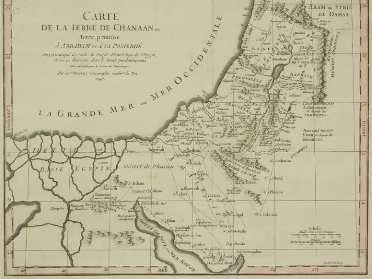
The Nile and the Birth of Egyptian Civilisation
By the time the Nile reaches Egypt it has already travelled thousands of kilometres across Africa. Yet its final stretch may be the most historically significant.
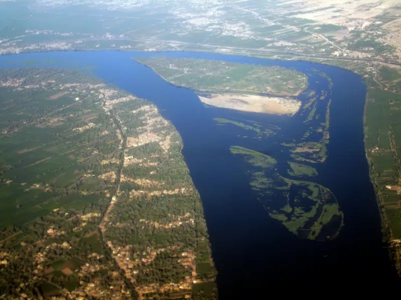
Across the Egyptian desert the river forms a narrow ribbon of fertile land surrounded by vast arid landscapes. For thousands of years this green corridor made agriculture, settlements, and cities possible.
Temples, towns, and fields developed along the banks of the river, making the Nile the central lifeline of Egyptian civilisation.
How Ancient Egyptians Understood Direction
Ancient Egyptians had their own distinctive way of understanding geography. Rather than orienting themselves primarily by north and south, they organised their world according to the flow of the river.
River-Based Orientation
- Upstream (south) was called Upper Egypt
- Downstream (north) was called Lower Egypt
These names reflect elevation rather than compass direction.
For the ancient Egyptians the Nile was not simply a river crossing the land. It was the axis around which the entire country was organised.
Their geography was literally river-centred thinking. The Nile defined orientation, agriculture, time, transportation, and even religious symbolism. The annual flood determined the agricultural calendar, while the river itself served as the primary route linking cities, temples, and communities.
In this sense, the Nile was far more than landscape. It was the structure of Egyptian life.
Experiencing the Nile Today
For travellers today, the Nile remains the thread connecting Egypt’s landscapes, history, and culture.
Between Aswan and Luxor, the river flows past ancient temples, small villages, palm groves, and desert cliffs that have witnessed thousands of years of human history.
Sailing the Nile offers one of the most meaningful ways to experience Egypt. Travellers can explore the river aboard:
- traditional felucca sailing boats, offering an authentic and peaceful journey
- elegant dahabiya vessels, combining classic sailing with comfort and spacious decks
Both experiences reveal how the Nile continues to shape life along its banks, just as it did in the time of the pharaohs.
A River Shaped by Deep Time
The Nile’s northward journey is ultimately the result of millions of years of geological change. The uplift of the East African highlands created the slopes that still guide the river today.
Long before pyramids or temples existed, the landscape itself had already determined the direction of Egypt’s future.
Sometimes the forces that shape civilisations are not political or cultural at all.
Sometimes they begin with something as simple — and as powerful — as gravity guiding a river toward the sea.